Homepage
 The Project  
 Cultural Landscape  
 Agenda  
 Landscape Convention  
 Library  
 GIS  
 The Team  
 Sponsors  
 Projects of the Partners  
 The Forum  
 Virtual Exhibition  
 Didactics  
 News  
 Service  
 
Imprint


Culture 2000

European Union


Landscapes in 3D-models

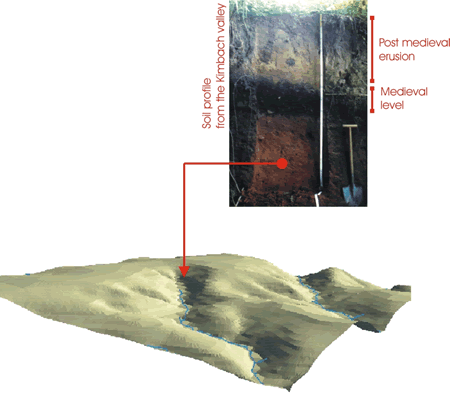
With GIS it is possible to develop 3d-models of landscapes.

Three-dimensional analysis allow to reconstruct and quantify the soil erosion and movement of sediments in the environ.


map
  
design: Kai M. Wurm
menu back print