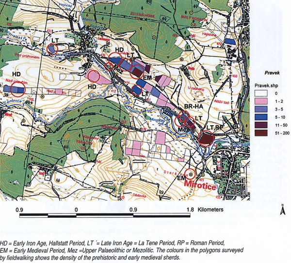
A small stretch of the Lomnice river valley of around 2km in length clearly demonstrates the density of settlement of the region in the second half of the 1st millennium B.C. A shallow river dominates the valley. Several, mostly extinct, streams flowed through the southern bank. The southern bank is dominated by a significant geomorphologic formation, the great "tumuli", most probably of natural origin, one third of which have been destroyed by extraction. Early Iron Age pottery shreds were found in their disturbed surface layers. Before systematic surface collection 2 La Tene settlement sites of about 500m distance from one another were known from the valley and an abandoned 12th century medieval village and 2 groups of tumuli from the cluster of woods bordering the valley to the north.
Surface collections have recorded the practically continuous cover of part of the valley by prehistoric finds. The northern slope was practically settled continuously, but towards the easterly, near slope by the village of Luckovice there are finds from the early (Hallstatt) and late (La Tene) Iron Age. On the southern running from west to east - there is a concentration of finds from the Mesolithic, Hallstatt, La Tene, early medieval (11-12th century AD), later prehistoric (HD-LT), Bronze Age??, Mesolithic, La Tene and early Roman periods. A very similar pattern is demonstrated by the settlement along the second significant Skalice River.